Overview
Full Mission Flight Testing is a crucial step in developing the drone (UAS). These tests evaluate the complete system’s performance by simulating real mission tasks, similar to those in the SUAS-25 competition. This report outlines the testing process and summarizes the outcomes.

1. Pre-Flight Checks
Before starting the mission, we carefully followed a pre-flight checklist to ensure the drone was ready for flight. This included:
System Inspection:
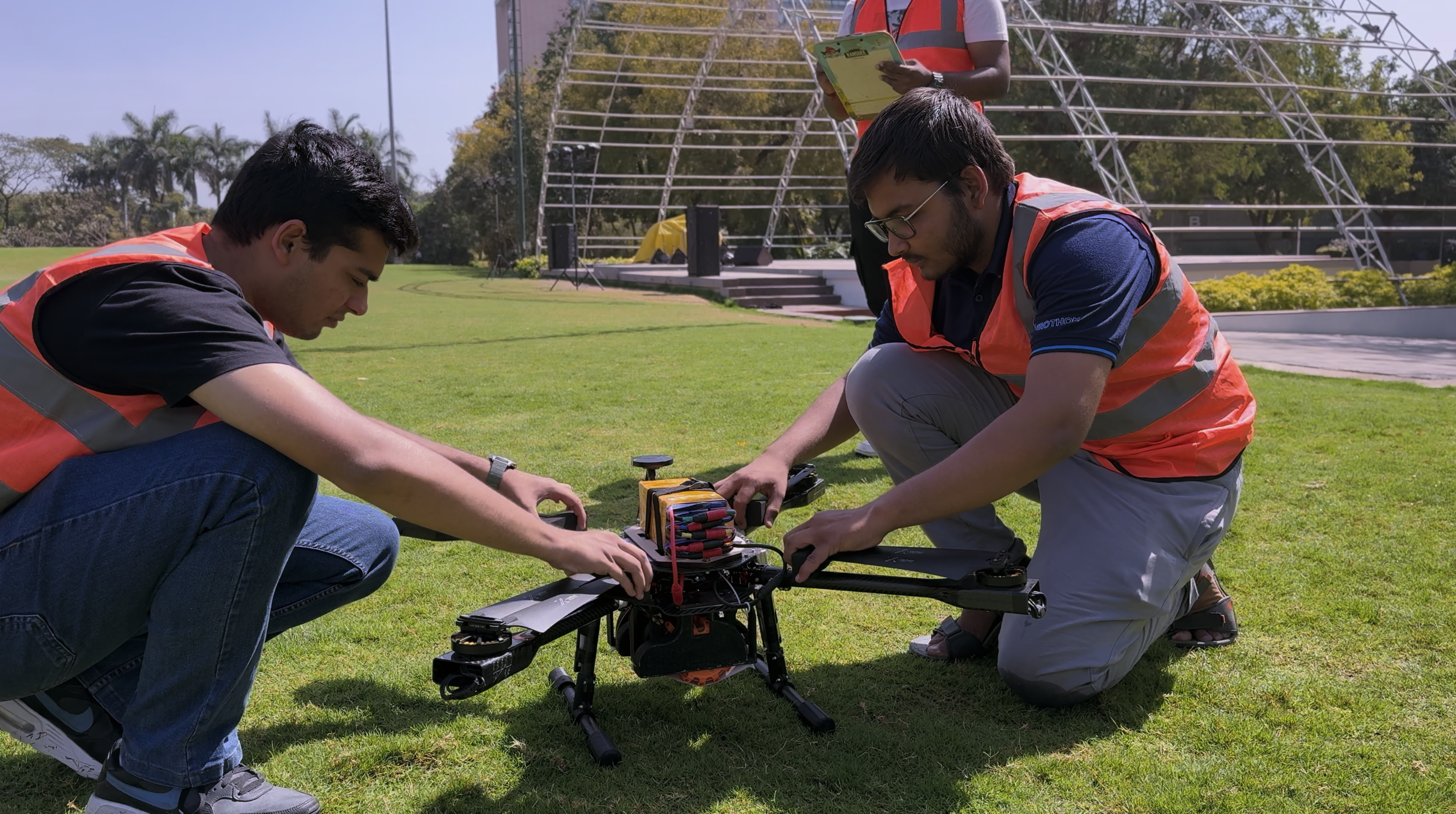
All hardware and software components were thoroughly checked. This included
verifying that the Pixhawk Cube Orange+ flight controller was functioning correctly and that all
mission parameters were properly configured.
Securing Components:
Key components such as the camera and airdrop system were securely mounted. All
screws, bolts, and connectors were checked and tightened to prevent loosening due to in-flight
vibrations.
Vibration Check:
A final inspection was carried out to identify and eliminate any potential sources
of excessive vibration, ensuring the flight controller and other components operated smoothly.
Final Adjustments:
Control settings were adjusted based on results from previous test flights and
current weather conditions to ensure optimal performance.
2. Flight Path
Before the flight, a path was planned with loops and waypoints. During the test, the drone followed this path and completed each part as expected.

3. Finding Targets
During the flight, the drone searched for specific ground targets using its camera. Some targets were confirmed in real-time by a ground operator monitoring the live video feed, while others were automatically detected using an onboard machine learning model. Once a target was identified, its location was recorded.
4. Airdrop Tasks
The drone was required to drop payloads at specific target locations. A total of four airdrops were executed:
The first drop occurred after completing the initial loop.
The second drop was triggered after identifying a new target during the second loop.
The third and fourth drops were completed in later loops after confirming additional target sites.
Each airdrop was performed at the correct time and location, demonstrating the precision of the release mechanism and navigation system.
5. Mapping an Area
During the second loop, the drone captured a sequence of overlapping aerial photos of a defined area. These images were used to construct a detailed map. The mapping process began while the drone was still airborne, with photos downloaded and processed in near real-time.
